
LISTED BUILDING · NHLE 1255414
Wall to Garden of Number 20
Wall to Garden of Number 20, Leominster
CHURCH STREET (South side) Wall on north-west and south-west of garden of No.20) Wall. Medieval and later. Sandstone rubble; C18 and C19 brick.
Dates and uses reflect the source records and may not describe the building today.
Designation information
Inclusion in the National Heritage List for England confirms that this is a designated heritage asset of national special architectural or historic interest.
Architectural evidence and features
These descriptions relate to particular parts of the building at the date of each source. They may not reflect its use or condition today. Unconfirmed features remain open questions.
Evidence reviewed 13 September 2026.
Documented type / function
- Garden boundary wall; possible relationship to Priory
Principal identity with historical and subsidiary uses explicitly separated
Medieval and later; 18th century and 19th century brick
Supported with qualification
Source and context
Historic England, NHLE entry 1255414
Applies to the named part at the source date, with the uncertainty stated. Current use and survival today have not been confirmed.
Documented phases
- Medieval and later; 18th century and 19th century brick
Source-specific phases, not administrative dates
Medieval and later; 18th century and 19th century brick
Supported with qualification
Source and context
Historic England, NHLE entry 1255414
Applies to the named part at the source date, with the uncertainty stated. Current use and survival today have not been confirmed.
External wall material
- Sandstone rubble
Wall
Medieval and later; 18th century and 19th century brick
Supported with qualification
Source and context
Historic England, NHLE entry 1255414
Applies to the named part at the source date, with the uncertainty stated. Current use and survival today have not been confirmed.
- Brick
18th century and 19th century wall fabric
Medieval and later; 18th century and 19th century brick
Supported with qualification
Source and context
Historic England, NHLE entry 1255414
Applies to the named part at the source date, with the uncertainty stated. Current use and survival today have not been confirmed.
Architectural features
- Wall extending about10m west and50m south
Only named component/phase in term and supporting description
Medieval and later; 18th century and 19th century brick
Supported with qualification
Source and context
Historic England, NHLE entry 1255414
Applies to the named part at the source date, with the uncertainty stated. Current use and survival today have not been confirmed.
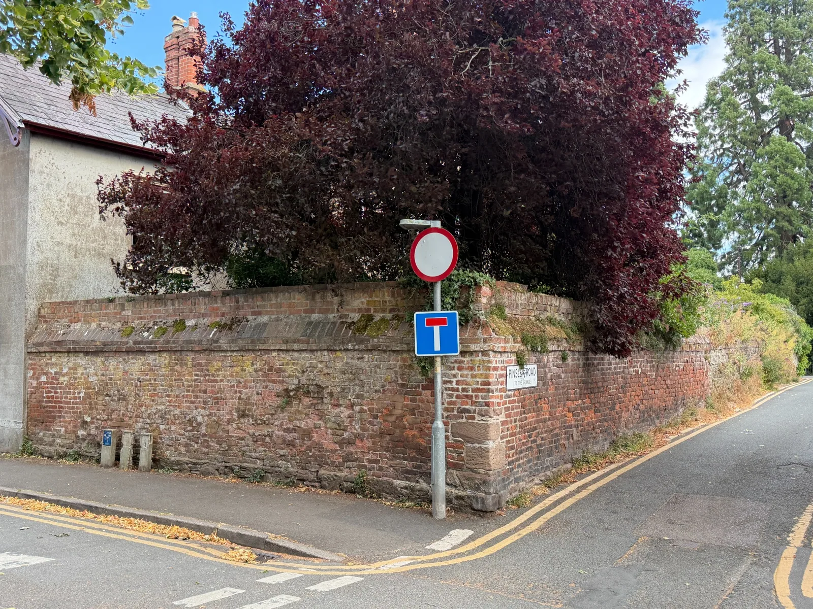
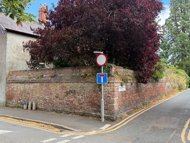
- Brick boundary wall; Rubble at lower wall; Dressed stone blocks at corner; Sloping weathering course; Brick coping; Mixed masonry; Open and eroded joints; Local colour/texture variations; Vegetation and moss
Visible principal subject only
Supplied capture date 2026-07-26, not independently authenticated
Supported with qualification
Source and context
Leominster Heritage photograph LH-IMG-000133
Applies to the named part at the source date, with the uncertainty stated. Current use and survival today have not been confirmed.
- Dressed stone corner blocks
Corner of boundary wall in supplied photograph; not ashlar construction throughout
Supplied capture date 2026-07-26, not independently authenticated
Supported with qualification
Source and context
Leominster Heritage photograph LH-IMG-000133
Applies to the named part at the source date, with the uncertainty stated. Current use and survival today have not been confirmed.
- Mortar joints
Visible boundary-wall bedding and pointing, binder and repair dates not identified
Supplied capture date 2026-07-26, not independently authenticated
Supported with qualification
Source and context
Leominster Heritage photograph LH-IMG-000133
Applies to the named part at the source date, with the uncertainty stated. Current use and survival today have not been confirmed.
Research notes and uncertainties
Component, chronology and current verification: Believed to relate to Priory is explicitly uncertain historical association, not church or chapel function. Non-building wall, no roof. Current use/survival not independently verified for September2026.
Medieval and later; 18th century and 19th century brick [Source-specific phases, not administrative dates; Medieval and later; 18th century and 19th century brick] Source chronology, administrative and reused-material dates separated. Believed to relate to Priory is explicitly uncertain historical association, not church or chapel function. Non-building wall, no roof.
Explore records with these reviewed features. Results may concern only part of a listed group and retain their source-date qualifications.
How this record is evidenced
The designation, listing date and statutory description are drawn from Historic England, NHLE 1255414.
Current survey photographs dated 26 July 2026 record the publicly visible fabric and features shown on this page.
The concise summary and searchable feature tags have been prepared by Leominster Heritage and are kept separate from the statutory wording.
The open questions below identify evidence that has not yet been securely established.
Map location
Loading map…
Wall to Garden of Number 20
Grade II · Medieval and later; C18 and C19 brick [Source-specific phases, not administrative dates; Medieval and later; C18 and C19 brick] · SO4959 CHURCH STREET 808-1/1/94 (South side) 24/07/54 Wall to garden of No.20 (Formerly Listed as:
CHURCH STREET (South side) Wall on north-west and south-west of garden of No.20) Wall. Medieval and later. Sandstone rubble; C18 and C19 brick.
Current survey photographs
Documentary evidence
Historic England
Official list description
Original NHLE location reference
SO4959 CHURCH STREET 808-1/1/94 (South side) 24/07/54 Wall to garden of No.20 (Formerly Listed as:
LEOMINSTER SO4959 CHURCH STREET 808-1/1/94 (South side) 24/07/54 Wall to garden of No.20 (Formerly Listed as: CHURCH STREET (South side) Wall on north-west and south-west of garden of No.20) GV II Wall. Medieval and later. Sandstone rubble; C18 and C19 brick. Extending for approx 10m west, then for approx 50m south. Believed to relate to the Priory. Listing NGR: SO4977159162
Sources and further reading
Open questions
- What evidence can establish the sequence and date of the building’s principal alterations?
- Which materials and architectural features can be confirmed by a dated site survey?
HELP IMPROVE THIS RECORD
Do you know more about this building?
Share a correction, photograph, source, occupier history or observation. Contributions are reviewed before anything is added to the public record.